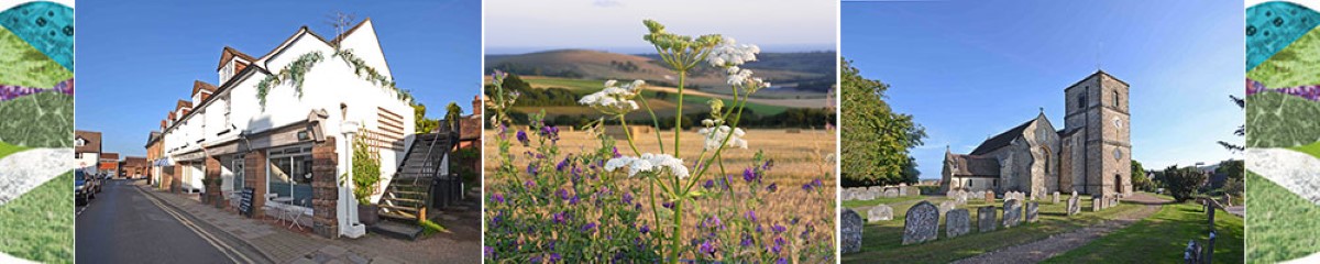
The history of Storrington
Storks and Artists
In 1086 the Domesday Book records Storrington as ‘Estorchestone’ a place well-known for storks. The history of Storrington has little to do with storks, and more to do with being a flourishing market place, with a fulling and tanning industry. In the early part of the 20th century it was also a centre of an artistic community.
Storrington was given permission to hold a regular market from 1399, as well as a twice-yearly fair. These continued until the end of the nineteenth century. Rabbit breeding was also once an important local industry, and is still indicated by various place names ending in ‘warren’, a place where rabbits were kept. At the end of the 19th century the White Canons built a priory. This became the home for a number of artists including the poet Francis Thompson (1859-1907) who spent two years trying to beat opium addiction, and Hilaire Belloc who stayed there in 1906. The noted composer Sir Arnold Bax also lived in Storrington.
The area attracted Wilfred Meynell, the poet and writer, as well as Arthur Bell (1875-1918) the disabled poet. Bell lies buried in the churchyard, his headstone was carved by the then up and coming sculptor Eric Gill¹. At nearby Sullington lived the writer A J Cronin.
Joan Ham, local historian.
¹Please note that sources vary in their attribution of the headstone mentioned here: some hold that the neighbouring headstone of Father George Tyrell, which is decorated with a chalice, is the one designed by the artist and sculptor Eric Gill.

Notes
The Downs from Above project is the aerial survey component of the National Trust-led and National Lottery Heritage Fund-supported Changing Chalk partnership.
Downs From Above – Interactive Map
As part of the Changing Chalk Partnership, over 190km sq of archaeology has been mapped using an archive of over 100 years of aerial photos and Lidar (Light Detection and Ranging) data. Picking out crop marks, parch marks and earthworks aerial investigators from Historic England have mapped a landscape, some of which is now lost under modern development, but most is now waiting to be rediscovered. We need your help to visit these sites, assess condition, and interpret what we see on the ground to learn more about how the landscape of the Downs has changed. We are also asking you to help enhance the stories our heritage tells us by adding your own memories, old photos or comments to the area.
The Changing Chalk Project is funded by the National Lottery Heritage Fund, the People’s Postcode Lottery and the Linbury Trust.
No Site Shot Available
Horsham District Archaeological Group
Horsham District Archaeological GroupGet involved in archaeological research in the Horsham area
Email: horshamarch@hotmail.co.ukINTERNET
Notes
The Horsham District Archaeology Group meets regularly to carry out research into the fascinating history and more distant past of Horsham and the surrounding West Sussex/Surrey countryside.
Activities include field walking, geophysical surveys, excavations, investigating landscape features such as mill ponds or deer park boundaries, examining written or visual records of all kinds and the processing or study of numerous finds (stone tools, pottery, clay pipe, metal artefacts and building materials) ranging in age from the Mesolithic period (perhaps 8000BC) right up to present times.
The Storrington and District Museum
The Storrington and District MuseumOpen Wednesday and Saturday 10am to 4pm, Sunday 10am to 1pm. Entrance: freeThe Old School School Lane Storrington, West Sussex, RH20 4LL home
Phone: 01903 740188work
Email: contact@storringtonmuseum.comINTERNET
Website: www.storringtonmuseum.com
Notes
The Museum aims at preserving yesterday for tomorrow. It houses local archaeology, articles from local churches, domestic history, details of local people and their memorabilia, artifacts of vanished local places, trades and services and articles from the two world wars. The Museum not only covers Storrington, but the surrounding villages of Amberley, Ashington, Bury, Cootham, Parham, Sullington, Thakeham, Washington, West Chiltington and Wiggonholt.
Look for our special events and talks on our website.
For Public Holidays and the Christmas period please contact the Museum: 01903 740188
Access to our archive collection by appointment only.
Notes
West Sussex Record Office was set up in 1946 to collect, preserve and provide public access to the archives of West Sussex. We hold archives from 780AD to the present day for local councils, churches, schools, police, courts, hospitals, businesses, groups and societies, families, landed estates (including Goodwood, Cowdray, Parham, Petworth, Standen and Wiston), the Diocese of Chichester and the Royal Sussex Regiment.
We also provide a Records Management Service for our parent organisation, West Sussex County Council, managing the modern records of the Council and its departments.
The Record Office is an Accredited Archive Service, governed by a statutory framework and delivered in accordance with national professional standards. It is approved as a Place of Deposit for Public Records by The National Archives and was designated as the Diocesan Record Office in 1949.
Our Mission Statement is: Your History, Our Future: Heritage Matters.
How we can help
With our vast collection of archives relating to West Sussex, some of which date back over 1,200 years, there are many things you can do:
- trace your family history
- study the history of your house (or any local building)
- discover the history of your local community
- explore old photographs
- research a military ancestor
- uncover information for a school or college project
- carry out research for a book or postgraduate study
- listen to memories of times gone by
- view old film footage of the local area
 See Horsham District’s history first-hand with these self-guided heritage trails exploring the towns, villages and countryside. Each trail is dedicated to a different area of the District and includes sites of special interest and stories from all eras of the area’s past. There are PDF leaflets to download.
There are several trails covering areas local to Storrington recorded by a local team organised by Storrington Community Partnership.
The trails project is supported by Horsham District Community Partnerships Forum and local history societies with National Lottery Heritage Funding.