Outdoor Activities
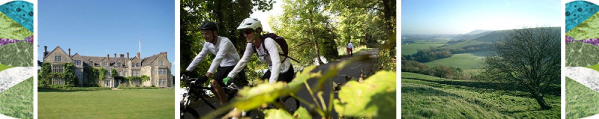
Storrington is a great centre for outdoor activities. Located at the mid-point of the South Downs Way, the Downs can easily be explored on foot, by bike, by horse or from the air by glider (flying the South Downs Ridge).
Although the paths to the Downs from the town are quite steep (roughly a 45 minute walk), there are also two car parks close by on the Downs that make the views easily accessible. From Kithurst Hill, right above the town, you can see: the sea along the Sussex coast, the Isle of Wight, Black Down (the highest hill in Sussex), the North Downs in Surrey and Kent and everything in between.
THE ROUTES TO THE DOWNS
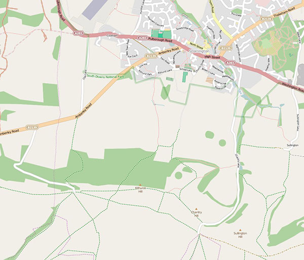
Click anywhere on this map to go to OpenStreetMap showing a contoured map with the paths from Storrington to the South Downs National Park and to the South Downs Way.
The paths to the Downs are quite steep. The South Downs Way is about 1.5 miles (2.5 kilometres) by footpath and 150 metres in elevation above the centre of Storrington and it takes about 45 minutes by foot. There is no parking up Greyfriars Lane, but there is a limited amount of temporary car parking by the South Downs Way at the top of Chantry Lane (Chantry Hill) and at the top of the unmarked road off Amberley Road (towards Kithurst Hill).
OpenStreetMap has a number of useful features for walkers and cyclists including a direction finder which recognises the paths.
LOCAL WALKS
Here are four local walks prepared for you by the Storrington & Sullington Community Partnership. This leaflet contains a brief description and map of each walk.
For a full description, click on the name of the walk below to open a PDF file. You are welcome to download and print out all of the information.
| Walk | Distance | Duration |
|---|---|---|
| North Storrington / West Chiltington Walk | 2.7 miles or 6 miles | 1 hour 20 min. or 3 hours |
| Short Downsland Walk | 3 miles | 1 hour 45 min. |
| Storrington History Walk | 45 minutes or 1 hour 10 minutes | |
| Sullington Hill and Downsland | 6-7 miles | 3 hours |
FIND WALKS NEARBY – CLICK ON THE ICONS
See Horsham District’s history first-hand with these self-guided heritage trails exploring the towns, villages and countryside. Each trail is dedicated to a different area of the District and includes sites of special interest and stories from all eras of the area’s past. There are PDF leaflets to download.
There are several trails covering areas local to Storrington recorded by a local team organised by Storrington Community Partnership.
The trails project is supported by Horsham District Community Partnerships Forum and local history societies with National Lottery Heritage Funding.
The Fancy Free Walks website is a guide for people who love to walk, to observe and enjoy our incredible countryside (and townscapes too) at a leisurely speed, and who like to read a little of the story behind the places they visit. Distances vary from a soothing 1½ km (1 mile) to a bone-shattering 42 km (26 miles).
The routes are described in fine detail using both text and maps. If you like careful and precise directions all along the way, these walks are designed specially for you!

West Sussex County Council has a range of information about outdoor activities. In particular, there is a downloadable leaflet describing trails suitable for all including wheelchair and pushchair users, families and less mobile people.
![]()
Walk between any town, city and national landscape in Britain. 10,000 A-to-B walking and wheeling routes, mapped and checked by the Slow Ways community.
Connect Storrington with Slow Ways. 6 more walks and reviews are needed to fully connect Storrington to the verified network.
![]()
ORGANISED ACTIVITIES

West Chiltington Lawn Tennis Club
Membership Secretary Contact: Lindy Williams
West Sussex Country Walks
Guides to countryside walks in West Sussex – see notes